Here is something about Madrid that many people may not know: a river runs through it.
But why is the Manzanares so much less famous than, say, the Thames, the Seine or the Tiber?
One reason is certainly that all of Madrid – not just its river – flies a bit under the radar, and the city’s features are not as widely known as those of London, Paris and Rome. This is one of the long-term effects of the cultural isolation that General Franco imposed on Spain for three decades after the end of WWII.
But there are other reasons, too. For one, the Manzanares only whizzes by Madrid’s town centre and plays a mere supporting role in the city’s commercial and cultural life – or its history. As a visitor, you can easily spend a week in Madrid without ever seeing the river or becoming aware of its existence.
Meet Madrid and Its Waterway
Madrid’s waterway is kind of well hidden in this way: stashed away in the suburbs, as one might put it.
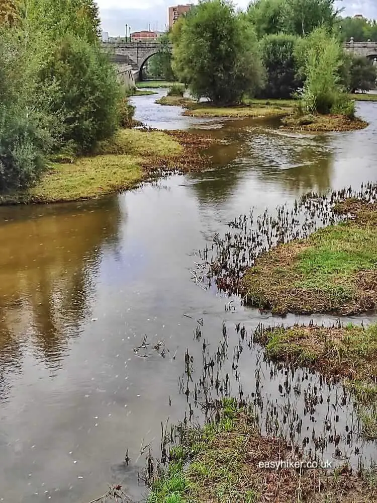
But above all, the Manzanares is so little known simply because it is not a major river, less than 100 km long and not fully navigable, for much of its length not even by small boats or canoes.
In the past, during Madrid’s long and hot summers, it regularly used to run totally dry. The French writer Alexandre Dumas visited the city in 1846 and reported that “no matter how hard I looked for the river, I could not find it”.
Its relatively modest dimensions have made the Manzanares the butt of jokes since (at least) the 17th century when a Austrian court official called it his “favourite river” – because, he explained, it was “navigable by horse and carriage”.
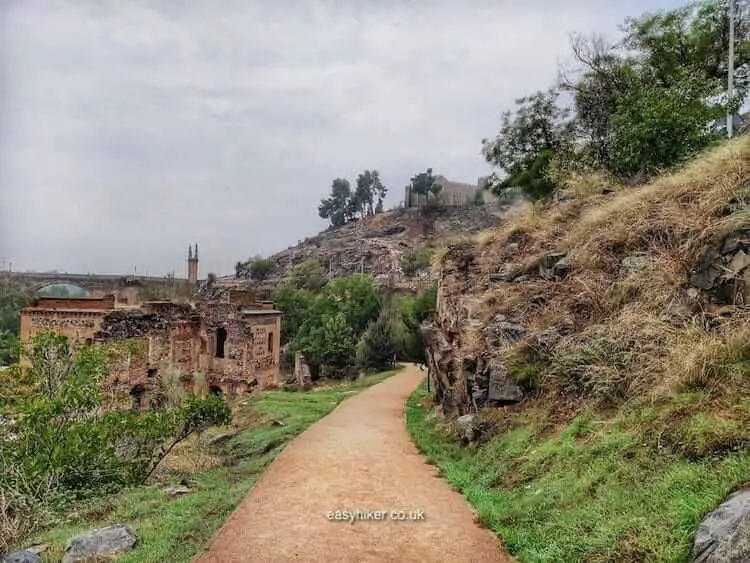
On top of that, throughout the city’s history, the Manzanares was lined by slum-like housing which was eventually replaced – in the 1960s – by a 6-lane motorway: 3 lanes on either side, heaping insult on urban blight. But it appears that few people in government ever seemed to care – or even think about the river very much.
All that changed, however, in the early years of the 21st century, when Madrid’s municipal administration decided to turn all the land on the banks of the Manzanares into one large recreational space for the public.
Previously neglected neighbourhoods were spruced up …
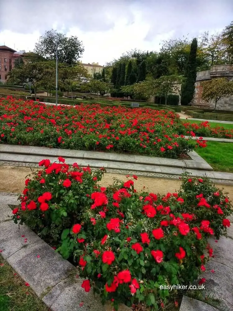
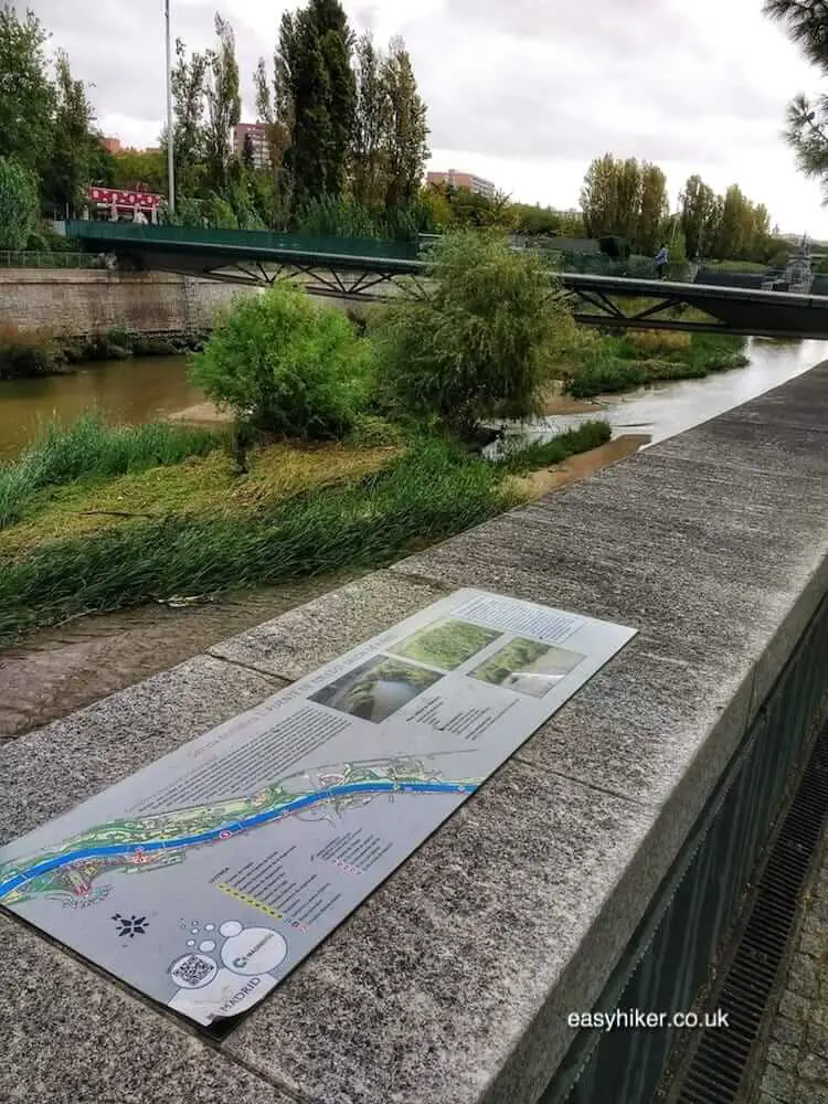
… and a landscaped route with info panels was charted to give the Manzanares a place among the capital’s visitor attractions.
None of this was done on the cheap: a cool €5 billion was pumped into the Parque Rio project, most of which was spent on a new tunnel for the motorway, allowing it to go underground.
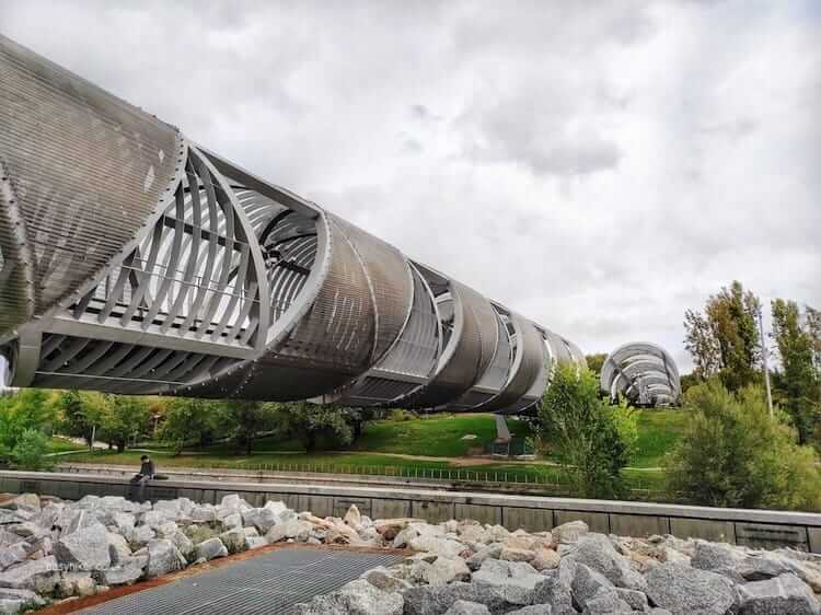
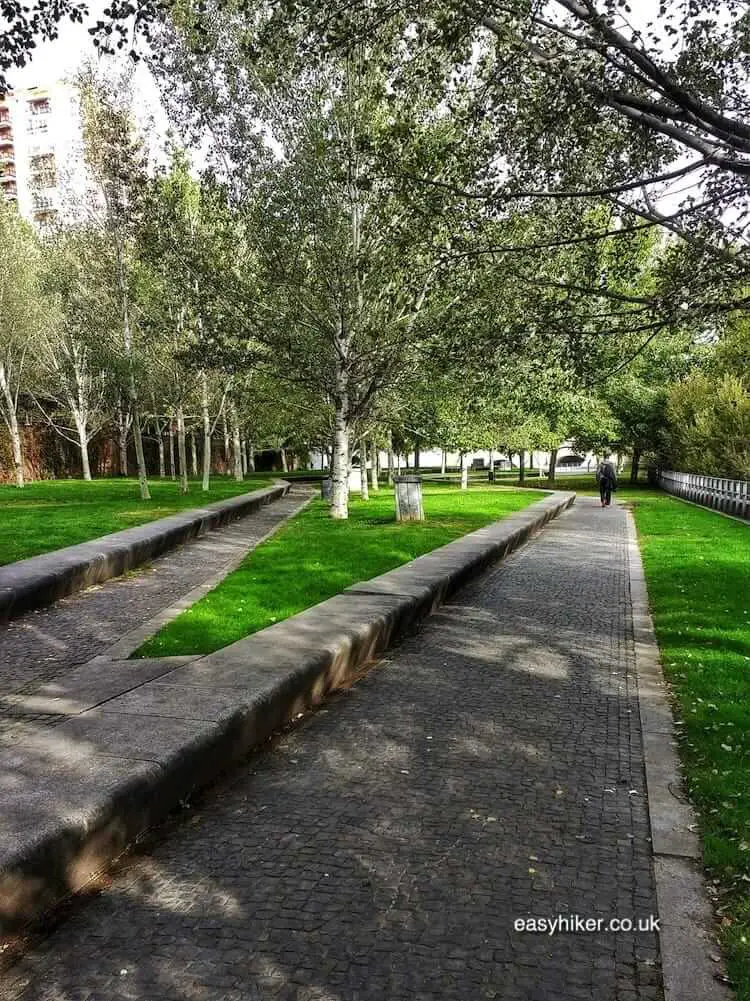
But a lot of money also went into the creation of connections between all the playgrounds, skateboard parks and walkways that were built on both banks of the river.
This produced a stunning variety of futuristic foot bridges such as the Puente Monumental de Arganzuela …
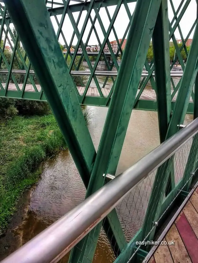
… and the equally innovative Y-shaped Puente del Principado de Andorra.
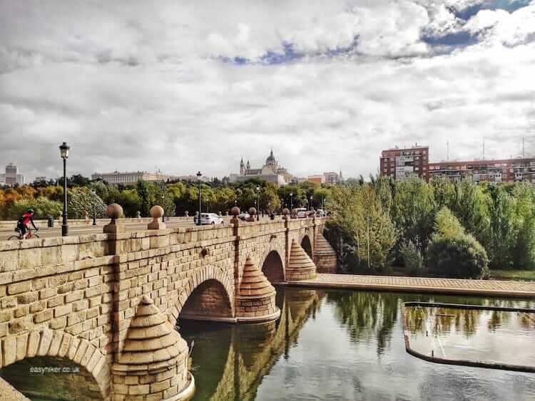
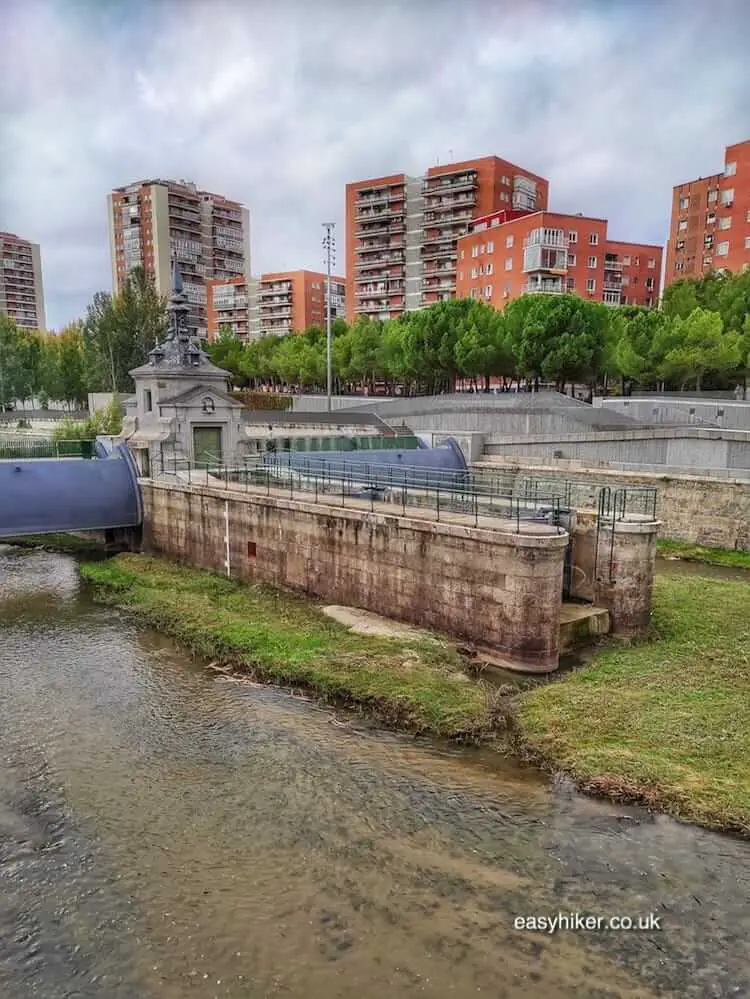
These futuristic constructions – not two of which are the same – also generated an interesting rhythm of the old and the new, thanks to the careful restoration and redesign of existing bridges such as the Puente de Segovia and the Puente de Toledo.
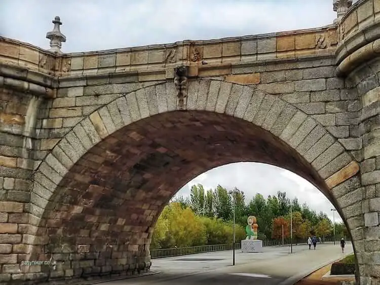
Both of these are true monuments of the Spanish Empire and, respectively, almost 500 and 300 years old, although the Puente de Segovia – the first bridge across the Manzanares that was built and the one nearest the town centre – is largely a modern reconstruction after the original had been blown up by Spain’s Republican government during the Civil War to prevent Franco’s rebel forces from using it to enter the city.
The redevelopment of the Manzanares covers a large area, in principle the entire lower stretch of the river from Manzanares El Real to Aranjuez (the riverwalk doubles up as the GR 124 Senda Real of the European Trails Network).
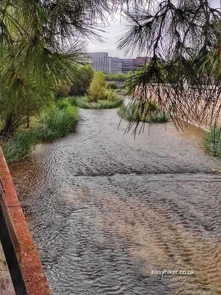
But we recommend to concentrate on the urban core of the trail between the metro station Padre del Pio and the Arganzuela park. You can spend a pleasant couple of hours on the route’s zigzagging paths that take you through an imaginatively landscaped scenery on either side of the river.
But here is a word of warning: big and modern buildings constantly intrude upon whatever idyll the landscape designers or Mother Nature herself may have created.
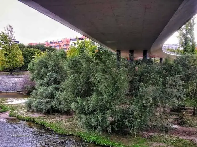
Inevitably so, because the face of Madrid’s southwestern quarters reflects the city’s history. The Habsburgs decided to build their new capital far away from the Manzanares for the same reason that property developers of later centuries opted for areas in Madrid’s north and east: the river, while dry for much of the year, could cause serious floods at other times.
Today, thanks to the late 19th century’s extensive regulation works, floods are no longer a problem, and Madrid’s city fathers would probably be grateful if the river, minor as it may be, could be redirected to give the town centre a picturesque flavour.
But while you can control and discipline rivers, …
… you cannot tell them where to flow. Or, rather: you can tell them, but they won’t listen.
Which is why the Manzanares River Walk will, for the foreseeable future, familiarize enterprising visitors not only with the city’s only waterway but also with its less fancy neighbourhoods.
Still: you will surely enjoy the walk if you bring not only a pair of comfortable walking shoes but also an interest in discovering what Madrid looks like beyond its historical centre.