
In terms of drama, scale and majestic beauty, few areas in Europe can rival the Italian Dolomites
For us, one way of rating the quality of our hikes is simply to count the number of pictures that we have brought home.
On some of our hikes in the past, we have made no more than 20 or 30 shots, sometimes with half of them showing the same motive – a lake or a particularly picturesque water mill, let’s say. After hikes like that, it can be difficult to pick the six or seven photos that are the bare minimum for a viable post – and to find something meaningful to say about them, too.
At the other end of the scale, there are hikes that leave us simply speechless, but for the exact opposite reason.
Read also: The Hub of the Dolomites
From our first hike in the Val Gardena of the Dolomites, we brought home at least 200 pictures, and is rare to find two shots that closely resemble one another.
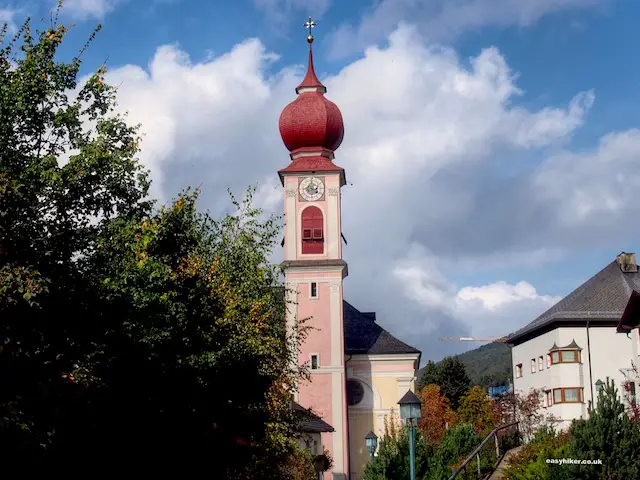
How can one convey all these impressions with a dozen picks and as many paragraphs? One can’t – not only because there have been so many impressions, but also because they were so rich in variety, ranging from picture-postcard views of Alpine villages …
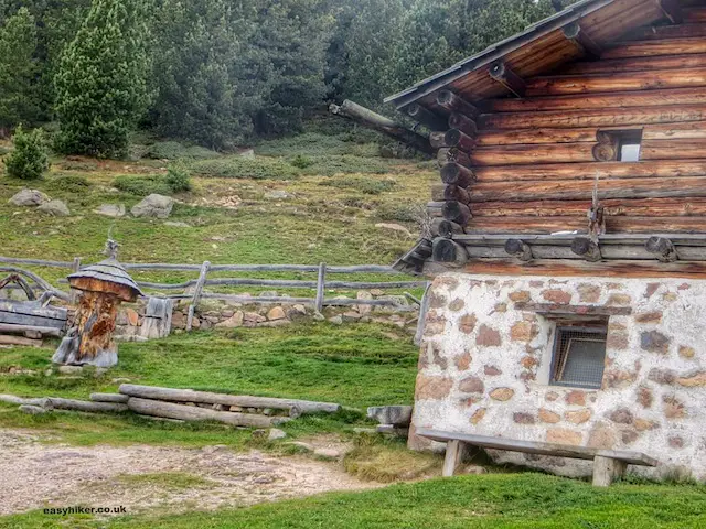
… and alpine farms …
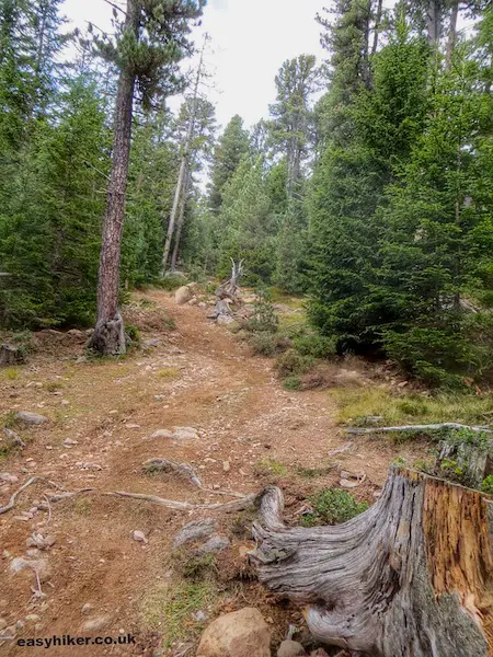
… via impressions from the “lowlands” with their lush mixed-forest vegetation …
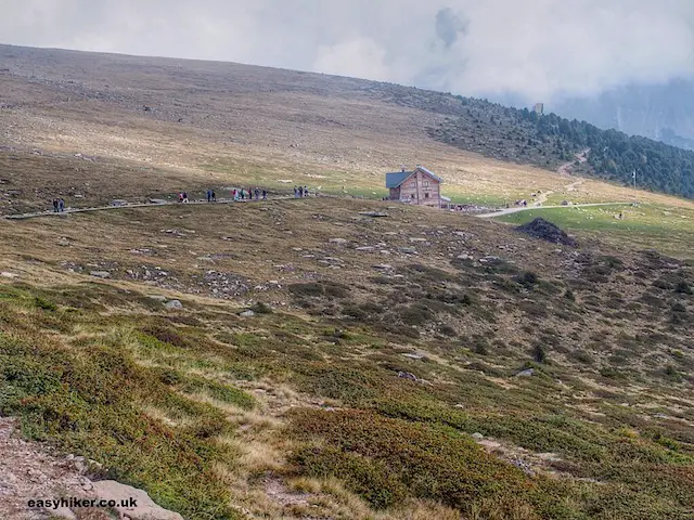
… and from the “prairies” beyond the tree line (an altitude of around 2000 metres) …
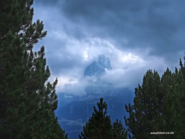
… to breathtaking panoramas featuring views of different mountains (this one shows the Langkofel, the Sassolungo, that tops the 3000 meter mark) …
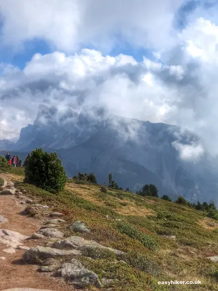
… and rock formations like the Geisslerspitzen. (The sky was slightly overcast on the day of our hike, which is not unusual in the Alps, certainly not in the autumn. Still, we could see two of the Geisslerspitzen’s “four tops” – not the whole Motown bill, but enough to make us happy all the same.)
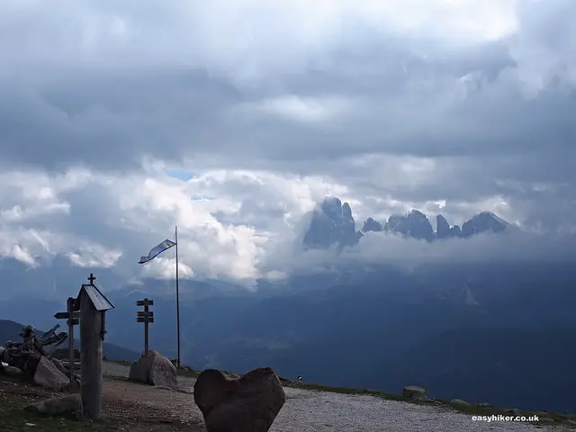
And finally, the climax of our trip: impressions from the (particularly graphic) gipfelkreuz – the “summit cross” – on top the mountain that we actually climbed ourselves …
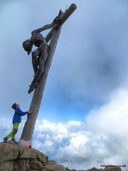
… the Raschötz (Rasciesa), 2283 m high, a proper Alpine peak. (Please note that we did this without any oxygen mask, artificial stimulants or help from sherpas. Are you watching, Reinhold Messner?)
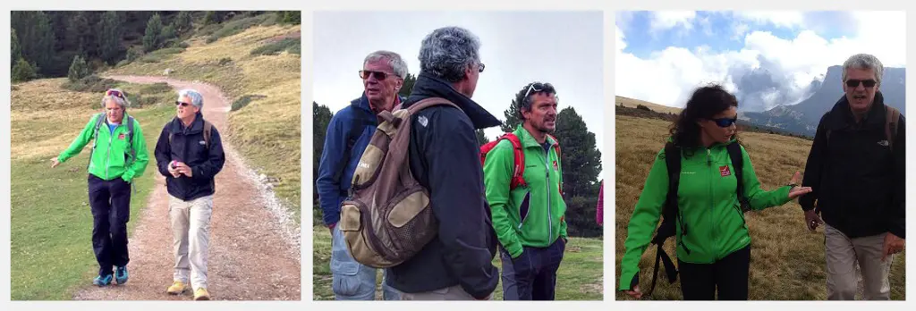
Our first Italian Dolomites hike had been organized by the guides of Hotel Adler, who also led our 50-strong-party up the summit and back, but there is no reason why you should not be able to do this on your own.
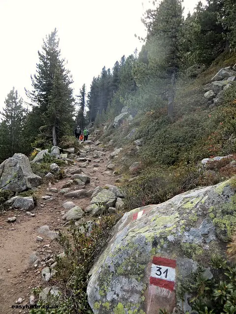
Just take the Mountain Lift (make sure to take the right lift, the one labelled Raschötz/Rasciesa: there are two others in town!), riding it all the way up to an altitude of 2093 metres, and then follow hiking trail no. 35 before making a left turn into trail no. 31 at the intersection.
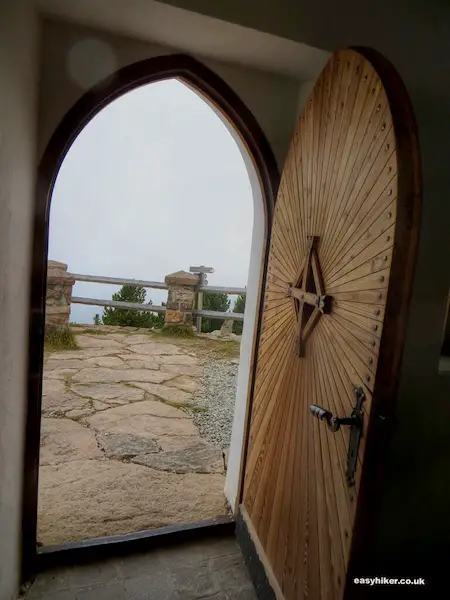
Continue straight from here all the way to the Radschötz summit (which is marked by the cross), pay a visit (a few steps down) to the Chapel of the Holy Cross …
… and make your way to the cabin, where, during the hiking season, you can have a light meal or a drink. (They will even serve you an espresso, although it may not have the full-bodied taste of a proper Italian coffee: you cannot produce the right amount of water pressure at this altitude.)
From the Rasciesa cabin, take route no. 35 back to the mountain lift. You can decide now either to take the lift down or, if you still have enough oxygen in your pack, to walk all the way back – in which case, you should follow route no. 9 and later route no. 5 straight to St Ulrich.
Read also: The Hills are Alive
Where those two routes meet, at roughly the half-way point of the descent, you will find the intermediate station of another mountain lift, the one up the Seceda, where you can change your mind if your tired legs (and knees: the way down is rather steep at times) make you regret that you did not take the lift option at the top station of the Raschötz lift.
Except for the descent, the trail is easy, without steep or long climbs, and excellently marked throughout – in red and white, always indicating the number of the trail you are on.
Up on the mountain, you will find a dense network of different trails that frequently intersect, so you can vary your itinerary and invent your own route.
Just be aware that some of the trails may be more physically taxing than others – and do not forget that the high Alps are, in general, a hostile environment. Do not even think of going for a walk in the mountains without enough water, a rain jacket – and, above all, a proper map.
I would not worry about that too much, Jason. Temperatures in the mountains are generally lower than in the lowlands, by roughly 5 to 10 degrees centigrades (depending on the circumstances) for every 1000 metres in altitude, so if you go really high up (beyond 2000 metres), July is actually perfect. Bring your suntan lotion, however: colder air does not mean that the sun is less intense.
Show quoted text
Love to do the hike. Is it not too hot to do it in June/July?
Interesting post ! Im amazed with nature in there. Its living in the wild …
Thank you, Mary. We’ve always wanted to go to the Dolomites and expected to be awed. And we were not disappointed. It delivered more than expected!
What a stunning hike! No wonder you came home with so many photos. It’s just spectacular scenery. I love the idea of the trails intersecting for route variations. Glad your trip here went very well.
We’d go back there again, given the chance, Leigh. It is truly amazing!
Hiking in the Dolomites is high, high on my wish list. Lucky you.
It was a fabulous trip, Jackie. We totally enjoyed it.
Simply fabulous, you two!! Could almost imagine us there with you (wish we had been!!!) Thanks for the post – beautiful photos.