Confession time for a hiking blogger

What I normally do after our hikes is this: I sit down, on the very same evening, to write down a few lines for later reference, so I will remember what happened when we eventually want to publish the post – which may be weeks, sometimes months after the event- you know – when details may have become a bit hazy.
Ideally, these initial notes will already impose an order on the day’s experiences, suggesting a theme like “La France profonde for beginners” or some such, and have, albeit, a rudimentary beginning, middle and end. At the very least, I sketch the rough outlines of the walk and note down some scattered observations.
The confession I have to make is this: it appears that this is not what I did after our walk around the town of Dourdan, a hike we undertook sometime in the autumn of 2011. The evidence, it appears, is incontrovertible.
Usually, at most a few weeks go by before I write it all up, but this time, there was always something else, something more pressing to tell you about, and the Dourdan file was glancing at me reproachfully all winter long from the folder of semi-finished posts.
When I finally opened the document last week, confidently expecting a solid framework of memories, a single paragraph stared at this hiking blogger.
“Past fields of corn and what we agreed may have been carrots. Note: it is a rare thing for Mrs. Easy Hiker and myself to agree on much during our hikes.
Also agreed that there was an easy way for us to find out whether or not we were right but that it was probably safer not to do this – for fear that Elmer Fudd (or whatever he is called in French) would jump out from his hiding place behind the bushes and, misreading our intention and mistaking us for a pair of hungry wabbits, firing away from his double-barreled shotgun.”
That was it. That was all I had written down from a long day of hiking: something silly about a couple of cartoon characters. What was more, I could not even remember having been afraid of Elmer Fudd. Or much else from that hike, for that matter. Wait a second: hadn’t there been a castle?
Eventually, I was able to piece it all together, like some Amnesia Man in a Hollywood movie, aided by flashbacks (“The Bourne Blogospheracy”) but also by Google Street View, the most useful app on the Internet, the pix we shot on that day and Mrs. Easy Hiker’s memories (although they focused predominantly on a piece of blood sausage she had bought in Dourdan from the town butcher).

So, if you want to follow us on a pleasant walk through the French countryside near the town of Dourdan, this is what you should do:
Take RER line C from Paris Austerlitz in the direction of Dourdan-la-Forêt and descend at Dourdan (the penultimate stop). After leaving the station, turn around and walk over the bridge across the rails.
Dourdan is a handsome small town with, yes, a castle, or at least the ruins of, right down in the centre. We first explored the place a little, bought some sandwiches and had a coffee before returning to the trail.
To get to the town centre, walk straight out of the station for a couple of blocks and then turn left. (It may be a good idea to visit the town before you go on your hike, despite the detour and despite the fact that, on the way back, you will cross the old town anyway, because by then, you may be too tired to really enjoy it.)

After crossing the bridge, turn right into Rue Pierre Semard and left into Rue de l‘Epine Blanche. Behind the small forest, turn right – following the red-and-white trail markers – and continue past the point where the GR111 turns left to take its red-and-white markers into the great blue yonder.

Your trail, a so-called Petit Randonnee which will be marked in red and yellow from here on, continues straight ahead.
Yes, straight, across the rough.

If you think this is counter-intuitive, you are not alone. Mrs. Easy Hiker, having apparently lost all the trust in my map-reading skills that she may have once had (I don’t blame her: I probably led that brave woman astray once too often), plainly refused to cut across the high grass in front of us, despite the fact that the map clearly instructed us to do so.
In the end I went alone, leaving Mrs. Easy Hiker to stand forlornly at the crossroads until, eventually, she followed (what else could she do? I was carrying the railway tickets in my backpack), but not without making sure that I felt her resentment grow with every step she undertook – in protest! – across the grass.

This went on for a few hundred metres – until a proper trail emerged out of the rough and we eventually spotted the red-and-yellow trail markers. (To end the mutiny right there and then. Oh, sweet triumph!)

After another kilometre or so, you will come to Châteaupers farm, one of the prettiest and oldest in this part of France. Some of the buildings actually date from the 16th century.

Just imagine: this farm and the surrounding farmland have existed in, more or less, their present shape since the days of the reformation.
North America was unsettled, London a cesspit, and Paris just a few blocks of timber-framed houses around the freshly completed Cathedral of Notre Dame.
But if a wanderer who came here first 400 years ago (“Easy Pilgrim”?) returned today, he would instantly recognize the place (provided his memory is better than mine).
So, we munched on our sandwiches a little bit in awe, while, from the heights of the barn roofs, four centuries of agriculture were looking down on our egg-and-tuna.

Just behind the farm, turn right and, after crossing (in that order) the railway line, the busy road and the river, left again, having passed the Mairie de Roinville and the Moulin Poissard, a provincial town hall and a French farm both straight from central casting.
One observation you can frequently make in rural France, more than almost anywhere else, is how much truth there is in the laziest of cliches. (Imagine coming to London, and everybody was wearing a bowler hat and an umbrella, queuing for the bus. In the fog.)

Behind the Moulin Poissard, turn right and continue for about one km until you reach another Grandes Randonnées trail, the GR1. Turn right here for your return to Dourdan. Yes, as Maurice Chevalier once said (or sang, to be more precise), I remember it well.

The hike was not too short, not too long, we were tired (if you are not tired after a hike, you did not do it properly) but not overly exhausted. There had been a good mix between interesting buildings and pretty landscapes.
It was, all in all, a thoroughly enjoyable trip – much more enjoyable than some that I can recall in excruciating detail. Not to forget: we had a row, and I WON!
But perhaps that was the problem: Perhaps the trip was so difficult to remember because it was so enjoyable, because not much went wrong.
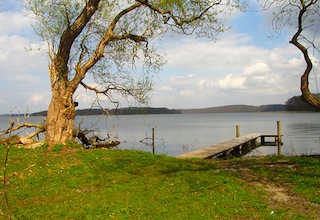
Perhaps I should have listened to Mrs. Easy Hiker on that junction and turned left. To continue all the way to the Atlantic Coast, presumably. “Now what lake is this? That’s not on my map.”